• Discover new ways to elevate your game with the updated DGCourseReview app!
    It's entirely free and enhanced with features shaped by user feedback to ensure your best experience on the course. (App Store or Google Play)

App for measuring distances

This. Thanks to all who brought up it. I used to suggest this but had a hard time convincing folks how easy it is and how accurate one can be. I did this stuff for a living for over 30 years ... before (and after) GPS. It isn't hard and I'll still bet anyone that, on reasonably open ground, I can be within +/- 2%.

Funny. I used to pace off 100 feet all the time setting rows on the farm and hadn't done it now for a few years. Recently I bet one of my buddies I could still do it within 2% as you suggest. I actually lost by less than 6 inches.
 
I pace things all the time for autocross, especially when I'm chairing events and building courses. We got a wheel and I can pretty much match numbers.

With that said, I always get distracted and lose count when I'm pacing my drives or take about 20 steps before I remember to start count.
 
While actual distance can be useful, it's trumped by being able to estimate effective throwing distance which is trickier to determine, even with the elevation angle provided on some laser rangefinders.
 
Funny. I used to pace off 100 feet all the time setting rows on the farm and hadn't done it now for a few years. Recently I bet one of my buddies I could still do it within 2% as you suggest. I actually lost by less than 6 inches.

Hey, 2.5% ain't bad, less than one step. I might lose one or two but I'll bet on the farmer every time.

Sometimes I think this is just another of those Manly Skills that are fading away over time. Right there with sharpening knives/tools with whet stones; building a fire when it's wet and lighting it on first attempt (without gasoline!); growing/killing/catching/finding one's own food; repairing engines and other equipment; and, yes, surviving that 5 mile walk to school, uphill, through the snow, barefooted.

The Dying Art of Manliness.
 
While actual distance can be useful, it's trumped by being able to estimate effective throwing distance which is trickier to determine, even with the elevation angle provided on some laser rangefinders.

Agreed, though a different skill with a different application. It's also something that gets MUCH more precise on the second attempt but, of course, the second attempt doesn't count. If I could just learn to make my second attempt first.
 
Agreed, though a different skill with a different application. It's also something that gets MUCH more precise on the second attempt but, of course, the second attempt doesn't count. If I could just learn to make my second attempt first.

First throw was short and left, more often than not I may try this.
 
If you want to get very accurate distances I strongly suggest an open reel fiberglass measuring tape. A decent 100 foot tape will be around $20. Metal ones tend to get kinks in them.
UDisc or phone measuring apps or handheld GPS devices will not be accurate enough.

 
I'm a road construction tech so...

tl:dr = measuring with tapes good - measuring with phones not nearly as good

I think that has nothing to do with UDisc. I'm fairly certain that's an issue with the location accuracy that the app is getting from the phone itself. The issue being that GPS tech requires direct line of sight to the satellites to be effective. I said +/- 16' earlier but that's in an open field away from any structures so it's no surprise to me that some UDisc distances can be off by as much as 100' in length which can easily happen when you're using it in thick foliage. And when a phone can't get enough sats for GPS it relies on cell towers to triangulate which is also notoriously inaccurate.

I'm pretty familiar with GPS tech because I use it all the time at work. We have a survey grade GPS rover that can get to 1/8" horizontal accuracy when the connection to the ground station and sats are good.

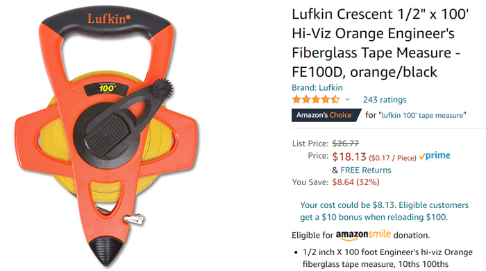
It amazes me that when this topic of measuring hole lengths some folks have such an aversion to using a 300' tape. It takes 2 people to do it quickly and WAY more accurately than a phone or a wheel plus they only run for about $30 at your big box store.

And by the way - a fiberglass tape is the way to go. Steel tapes are $$$ and require you put a certain amount of tension on them - which is why hardly anyone uses them anymore. ;)

That is a fact.

Before SmartPhones had GPS, I had a Garmin GPS device that I used for GeoCaching and kayaking. The cool part about it was that it showed how many satellites it was connected to and the signal strength from each one....along with that, it showed the +/- accuracy. You could see the accuracy change based on the number of satellites and the signal strength of each one. It was pretty cool.
 
When measuring, the bottom line is how accurate do you need/want to be. For the course I played the most, one of the club members had access to surveying equipment, which is really accurate. He used it for every hole and they used that for the signage. If 'close enough' is good enough, you can just pace it off.
 

Latest posts

Top